AI Hackathon - 3rd Prize
EcoVision - AR System for Climate Collapse
When was the last time you saw a fox in NYC?
Has it been 1 week...
A Month?
Or A Year?
The Prompt - AI X System
The Year is 2030.
Climate collapse has accelerated. Megacities face extreme heatwaves, flodding, and ecosystem collapse - while rural areas grapple with desertification and biodiversity loss.
Governments and corporations are locked in bureaucratic paralysis, and traditional environmental policies are too slow to adapt.
How might we use AI to mediate between human and ecological needs in urban spaces?
Create a citu-scale AI that works between humans, wildlife, and climate systems - balancing urbn needs with ecological repair in real-time.
Timeline
Problem Break Down
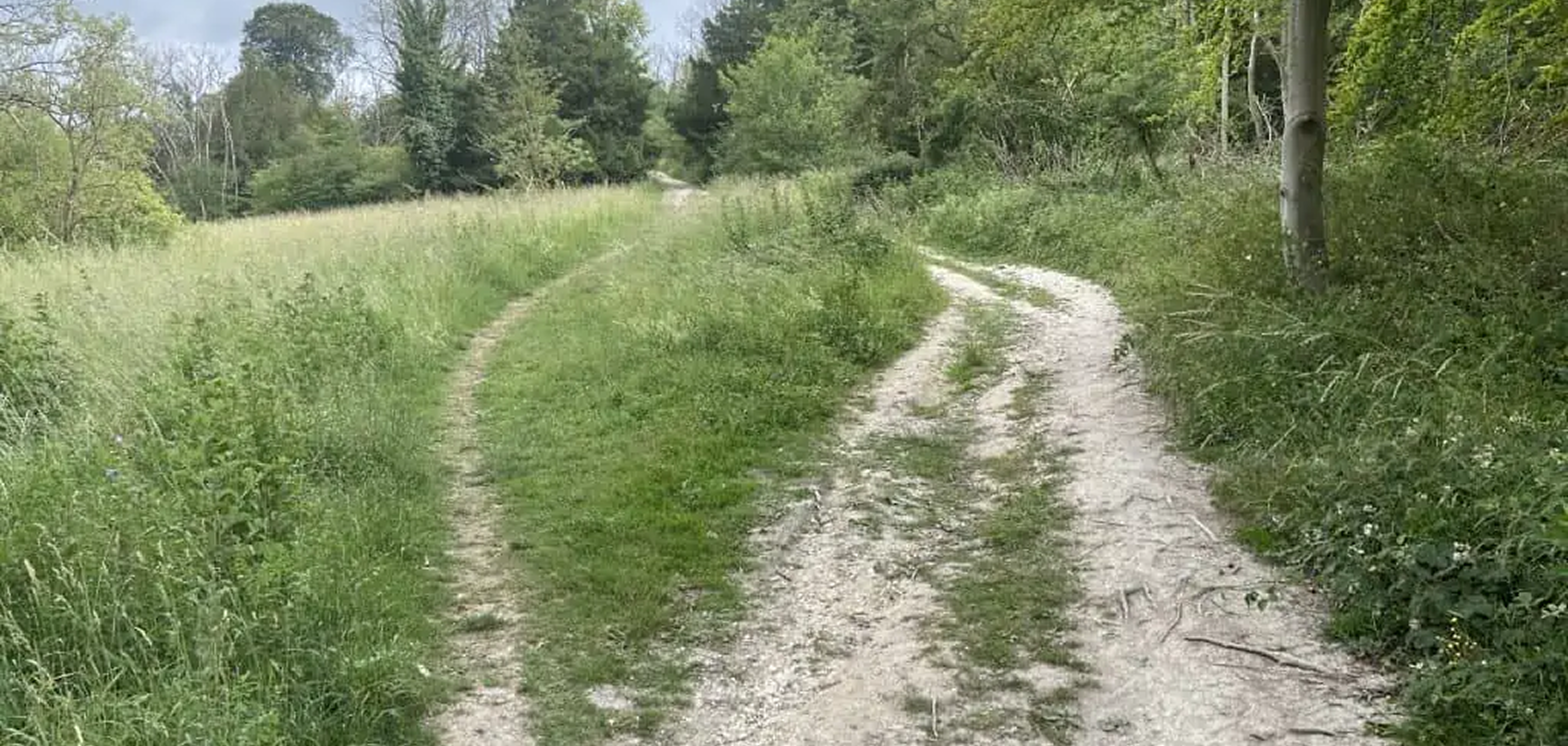
1. Foot traffic and human intervention
Human foot traffic often creates desire paths.The number of people walking through an area. Example: Too much foot traffic can damage grass or natural habitats. People across the grass in unofficial trails formed by repeated walking, usually the shortest or most convenient route between two points.
2. Urban heat island effect
Cities tend to be significantly hotter than nearby rural areas because urban materials such as concrete, asphalt, and brick absorb and retain heat throughout the day, then slowly release it at night. In contrast to the natural landscapes found in the countryside, urban environments often lack sufficient green spaces like parks, trees, and vegetation, which naturally cool the air through shade and evaporation.

3. Water inaccessibility
When people, animals, or plants lack reliable and convenient access to clean, fresh water needed for survival and healthy living. This can lead to dehydration, poor health, and even the inability to thrive in certain environments. For example, a park that lacks water features such as fountains, ponds, or irrigation systems may become too dry to support certain types of plants or attract wildlife.

4. Pollution
Such as improper waste disposal / garbage accumulation. In some areas, the lack of sufficient garbage bins leads people to discard their waste directly onto the streets. This careless disposal not only creates unsightly and unhygienic public spaces but also poses serious threats to the environment we live in. Over time, accumulated waste can release harmful chemicals into the soil and water, contributing to pollution and potentially affecting human and animal health.

The
Painful
Truth...
The truth: any time human interaction
No matter what we do, most of the time when human intervention is involved in natural spaces, it affects wildlife.
HMW
“How might we visualize alternative possibilities that optimize existing spaces and translate them into a better future for Biodiversity in the NYC?”
Position Statement
Why AR?
Superimpose "future possibilities" directly on the real world, allowing people to intuitively perceive the potential of ecological restoration
Features
1. Real Time AR
This feature allows users to view optimized changes instantly within their physical environment. By using a device’s camera and AR capabilities, users can see modifications—such as layout adjustments, design enhancements, or interactive elements—applied in real time, creating a seamless and immersive experience. This functionality helps users visualize outcomes immediately, make informed decisions, and engage more deeply with the content or product.
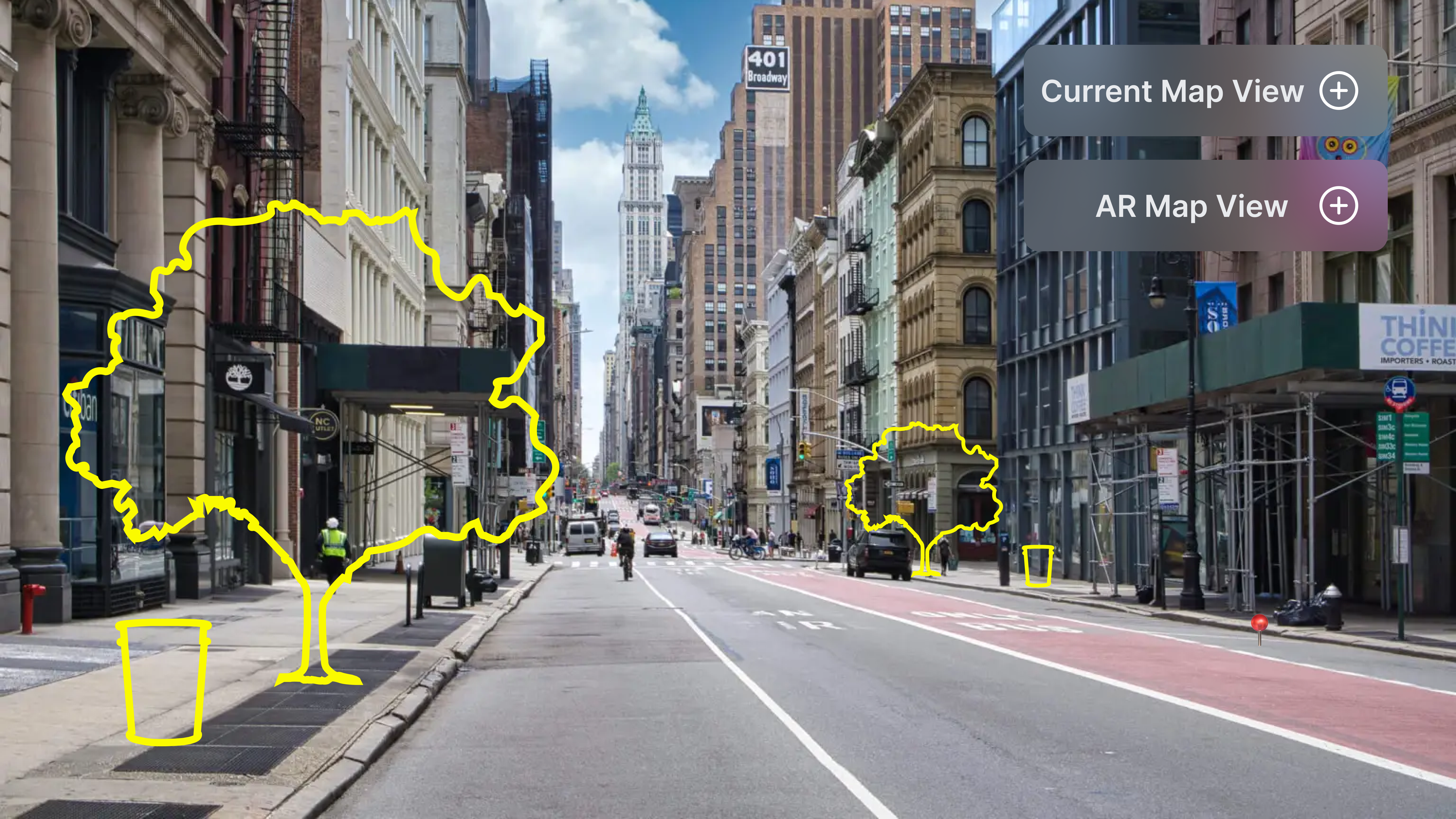
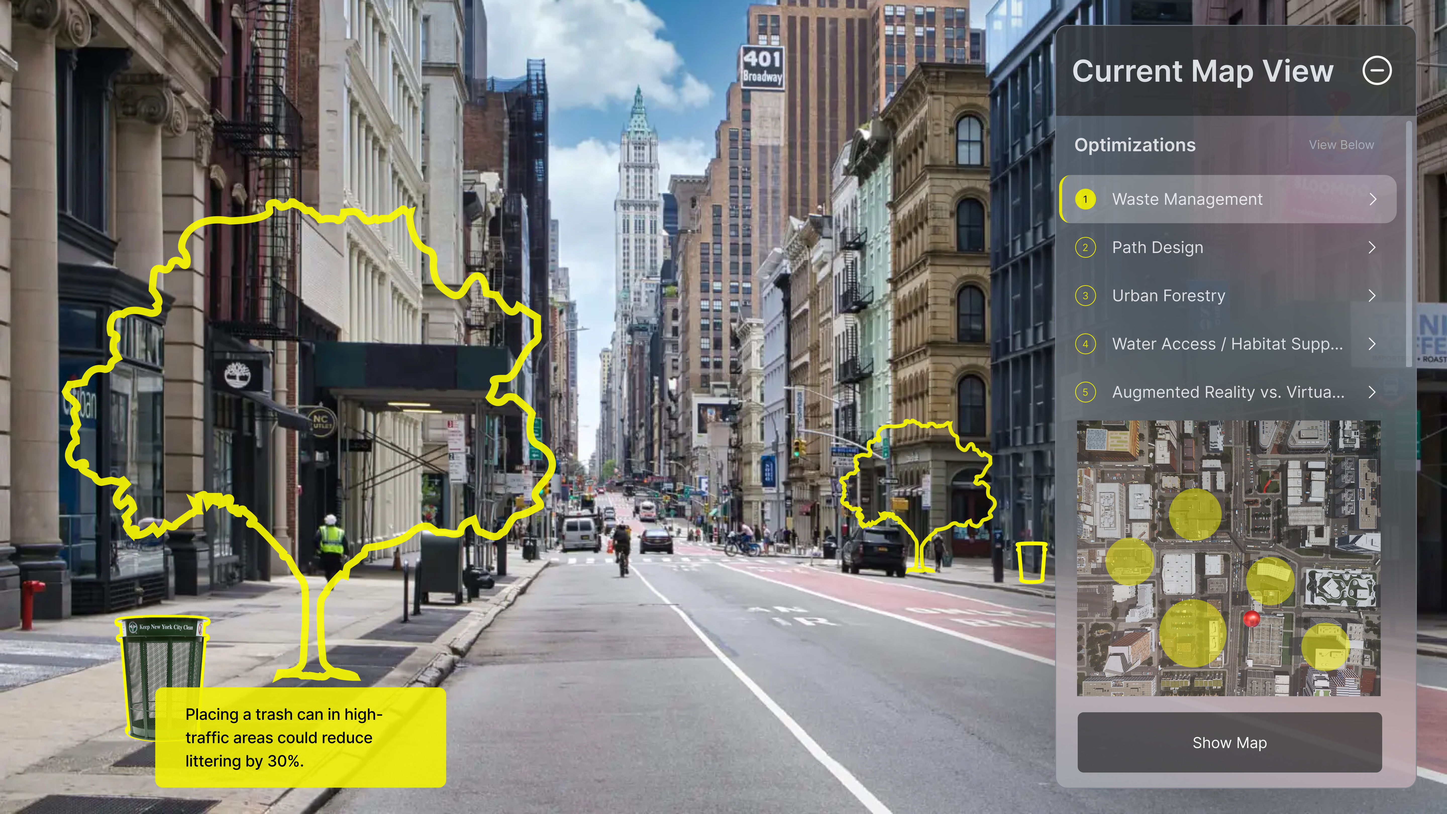
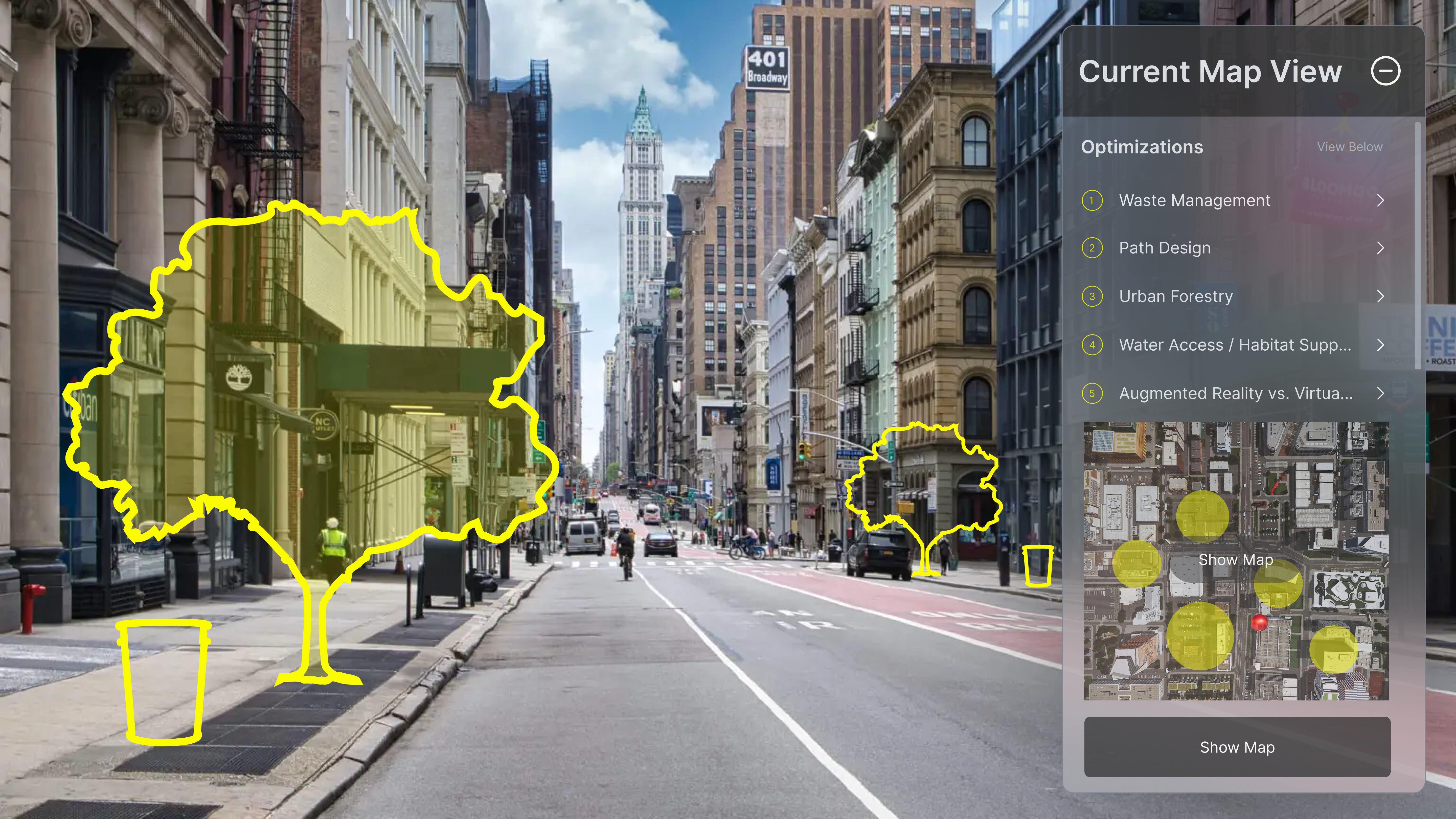
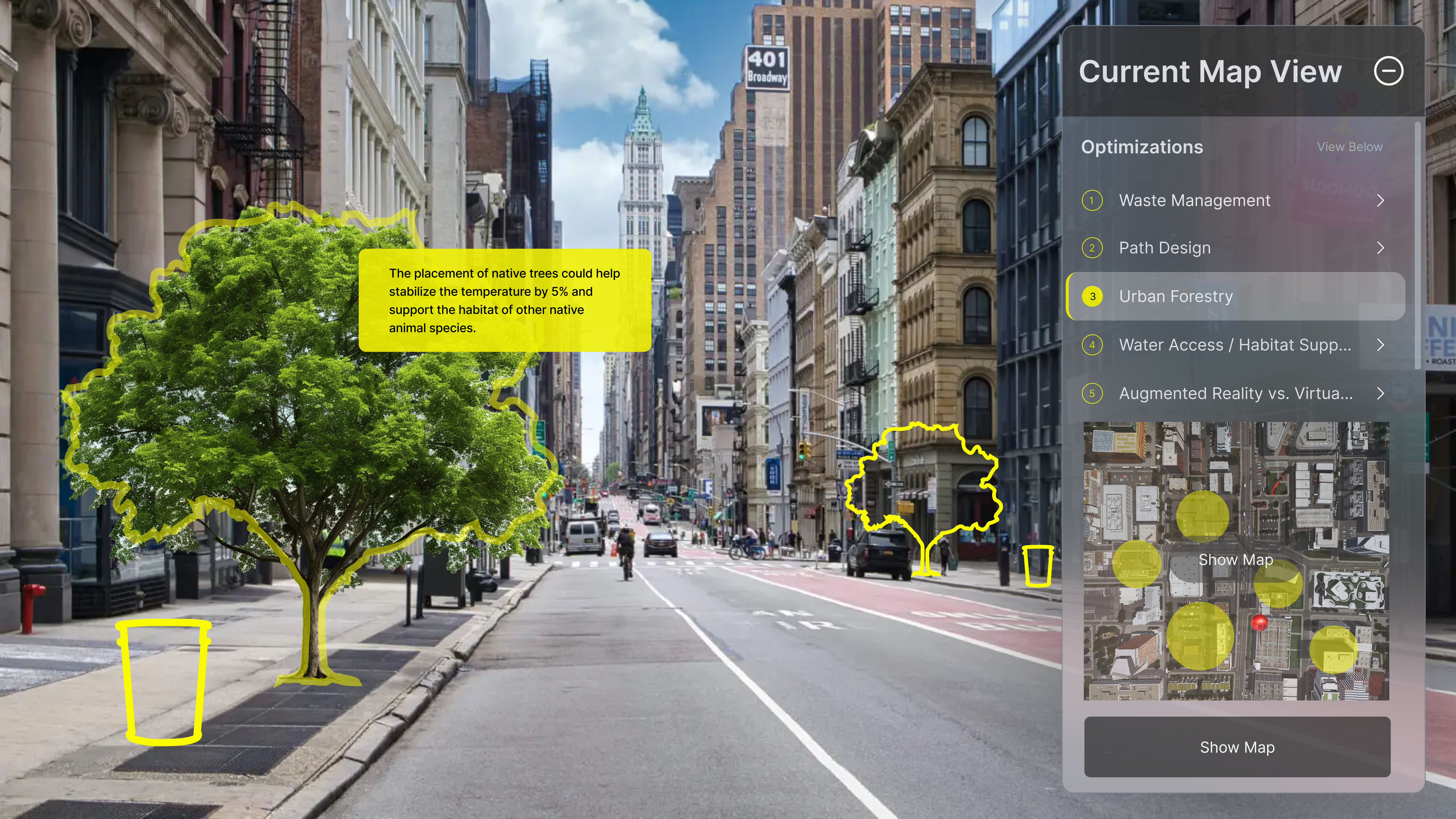
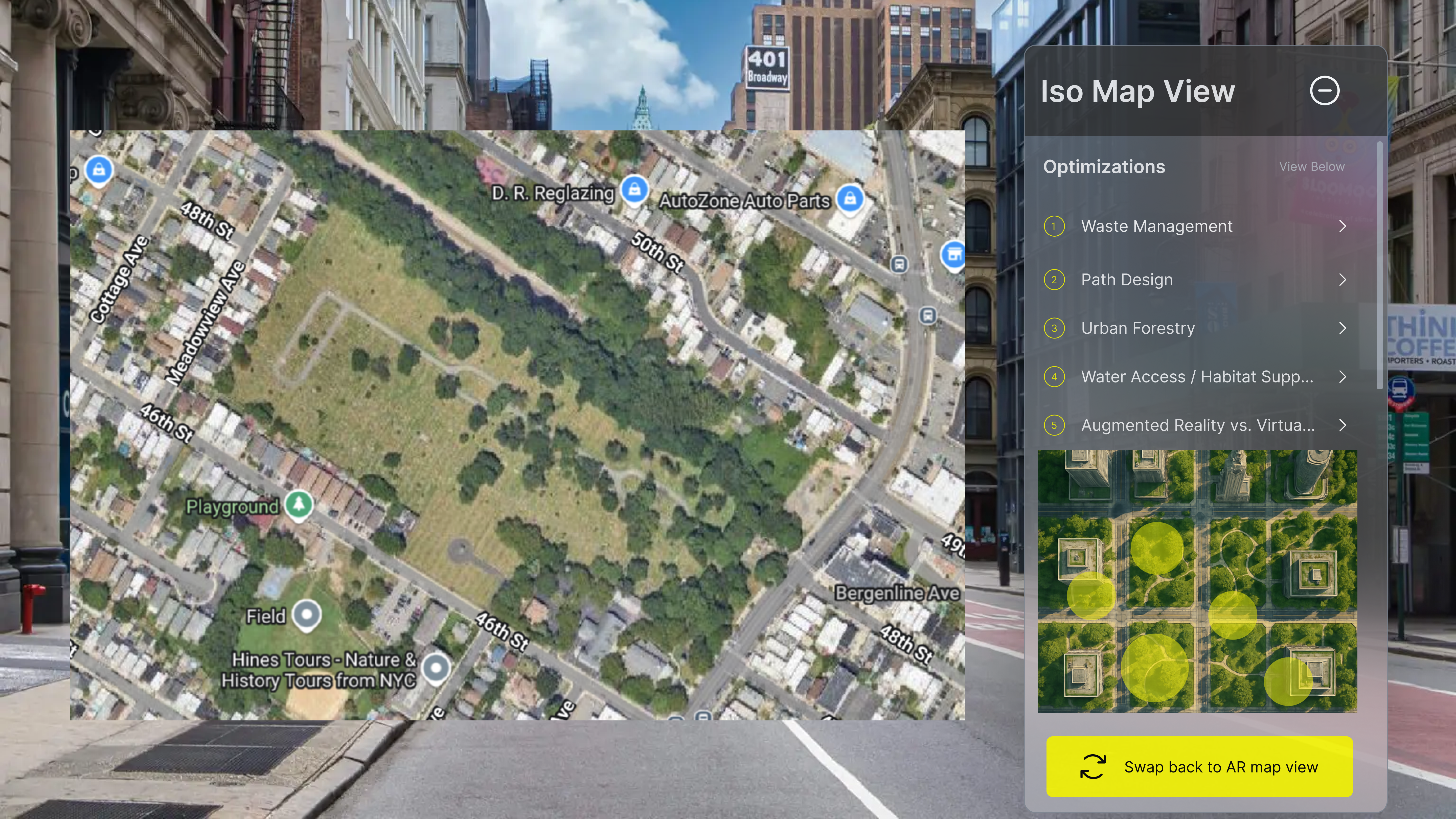
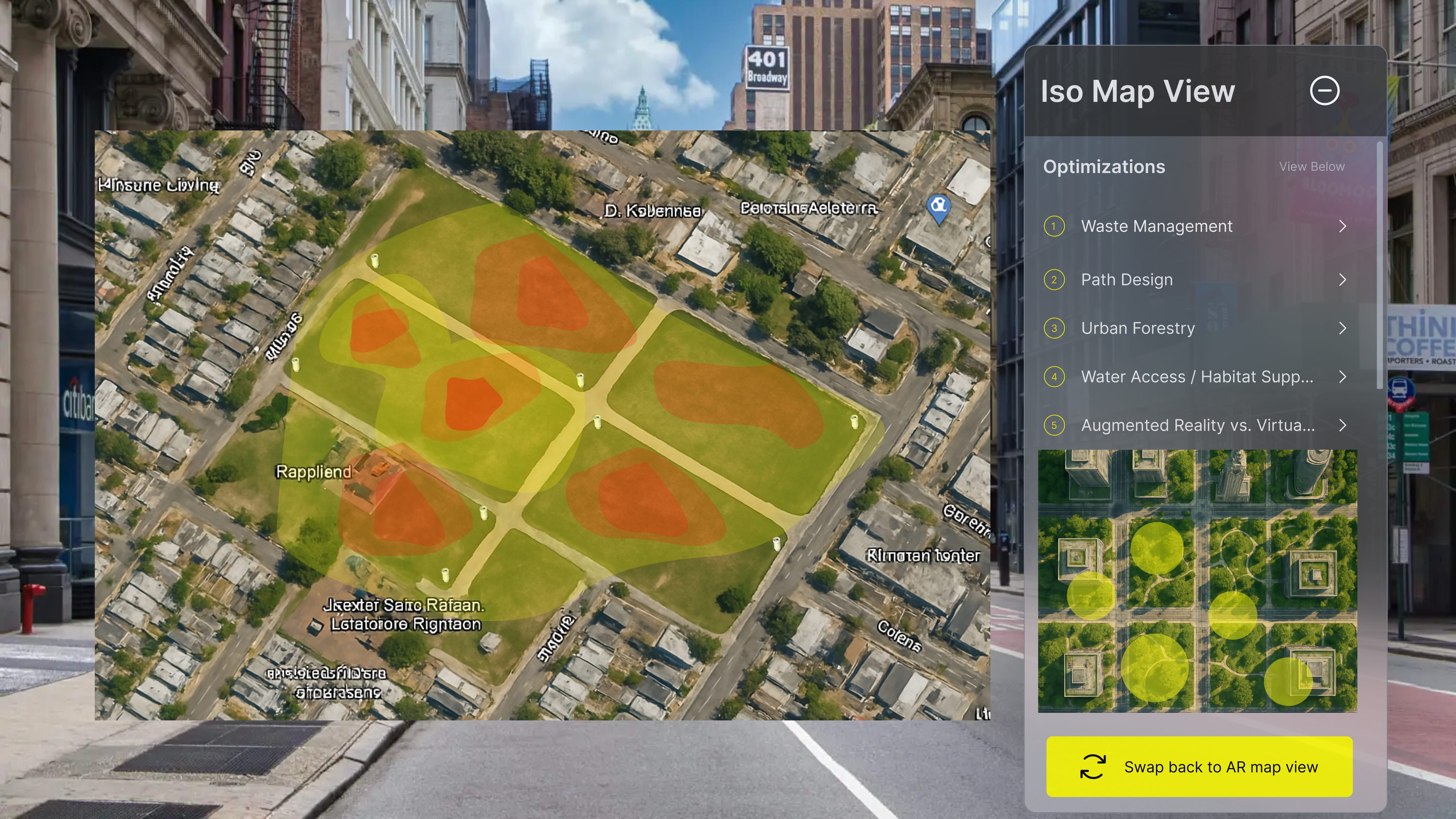
2. Current Map View
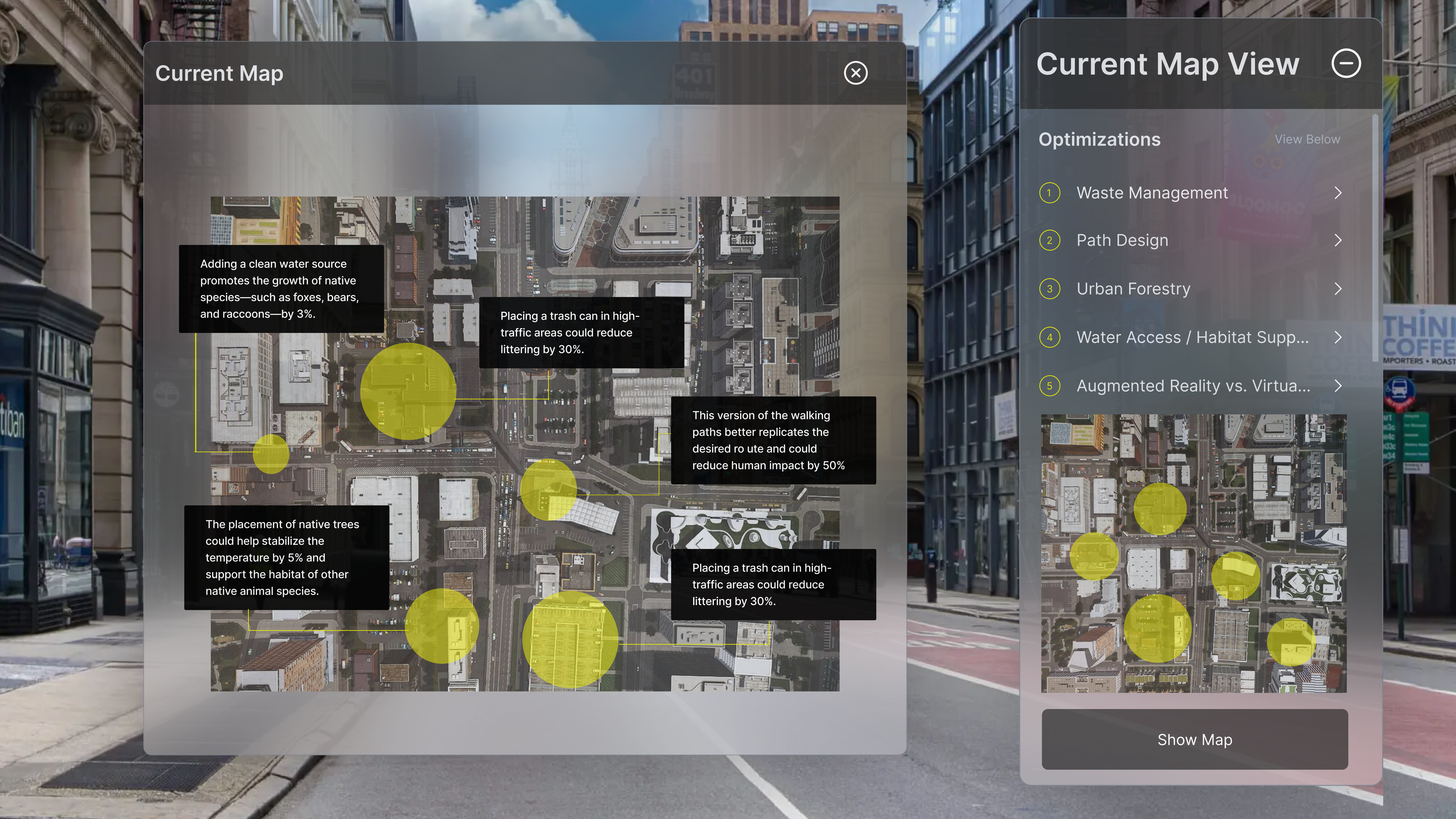
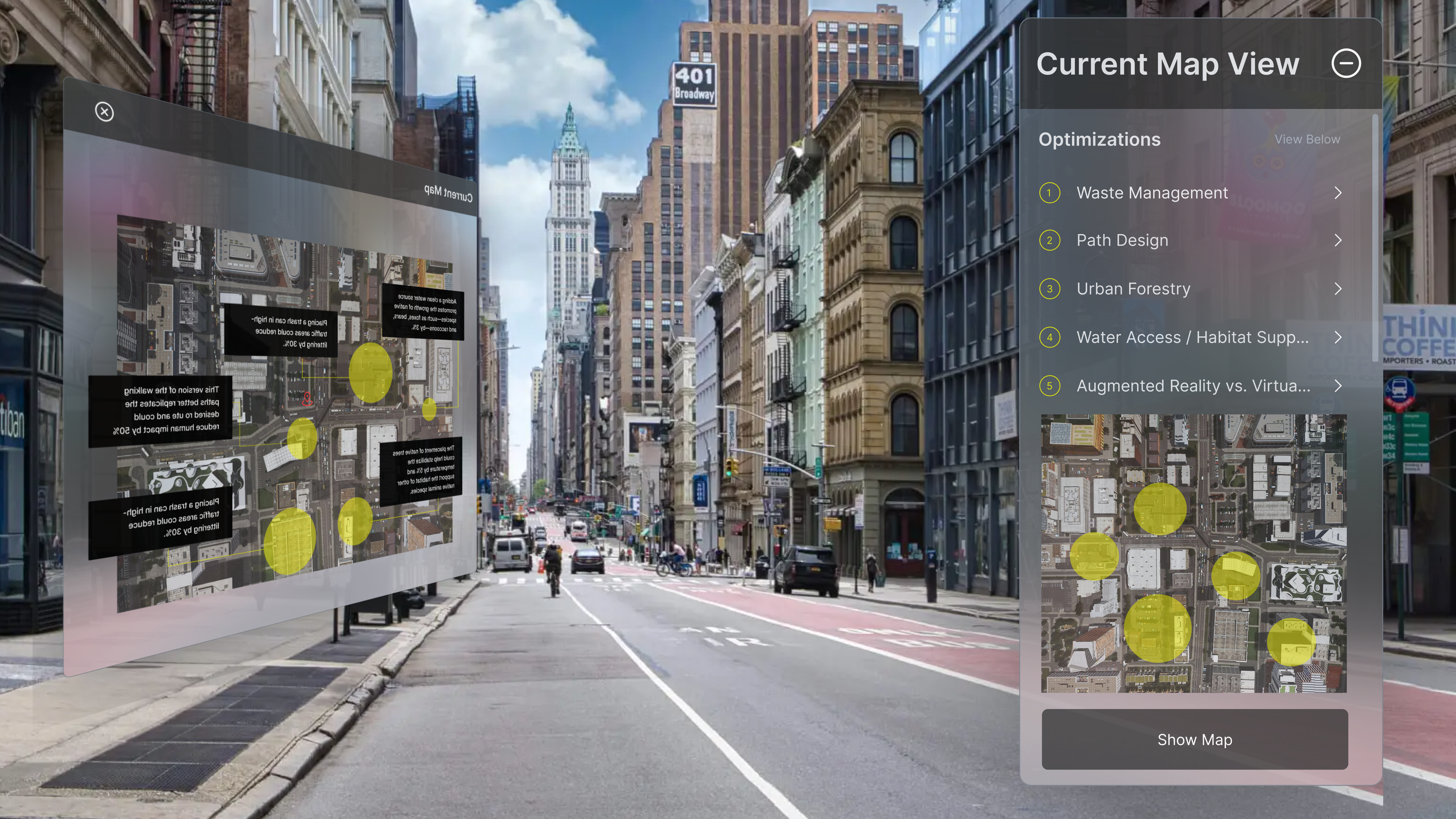
Current Map View provides users with a real-time visual of where specific environmental issues are occurring in relation to their current location. The yellow circle is the problem area. This feature is particularly valuable in outdoor settings, as it helps individuals navigate and respond to problems—such as pollution, habitat disruption, or improper waste disposal—within their surroundings. By allowing users to see these issues as they happen, the map view encourages timely action and greater awareness, ultimately supporting efforts to protect and preserve local ecosystems through informed, location-based engagement.
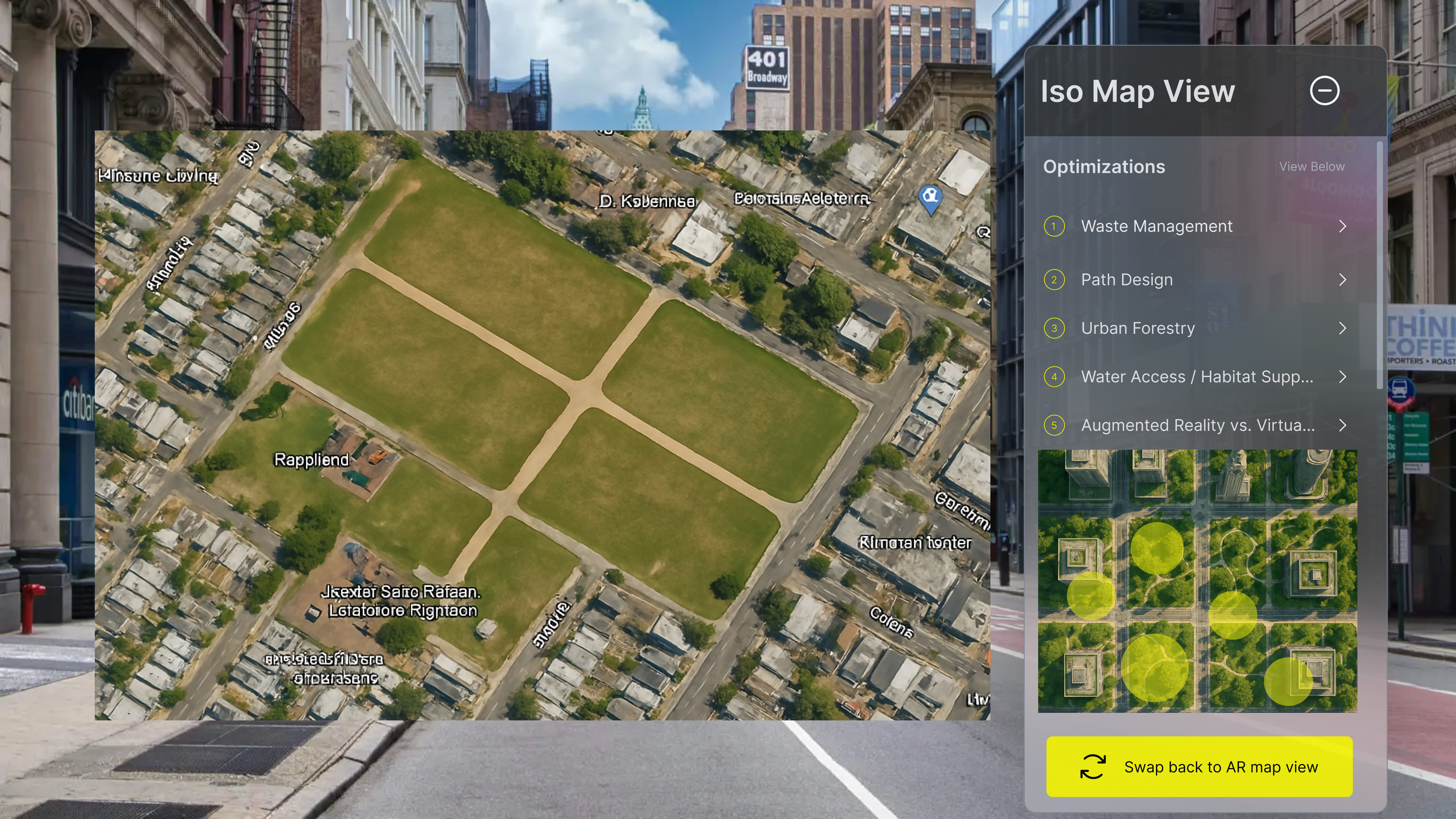
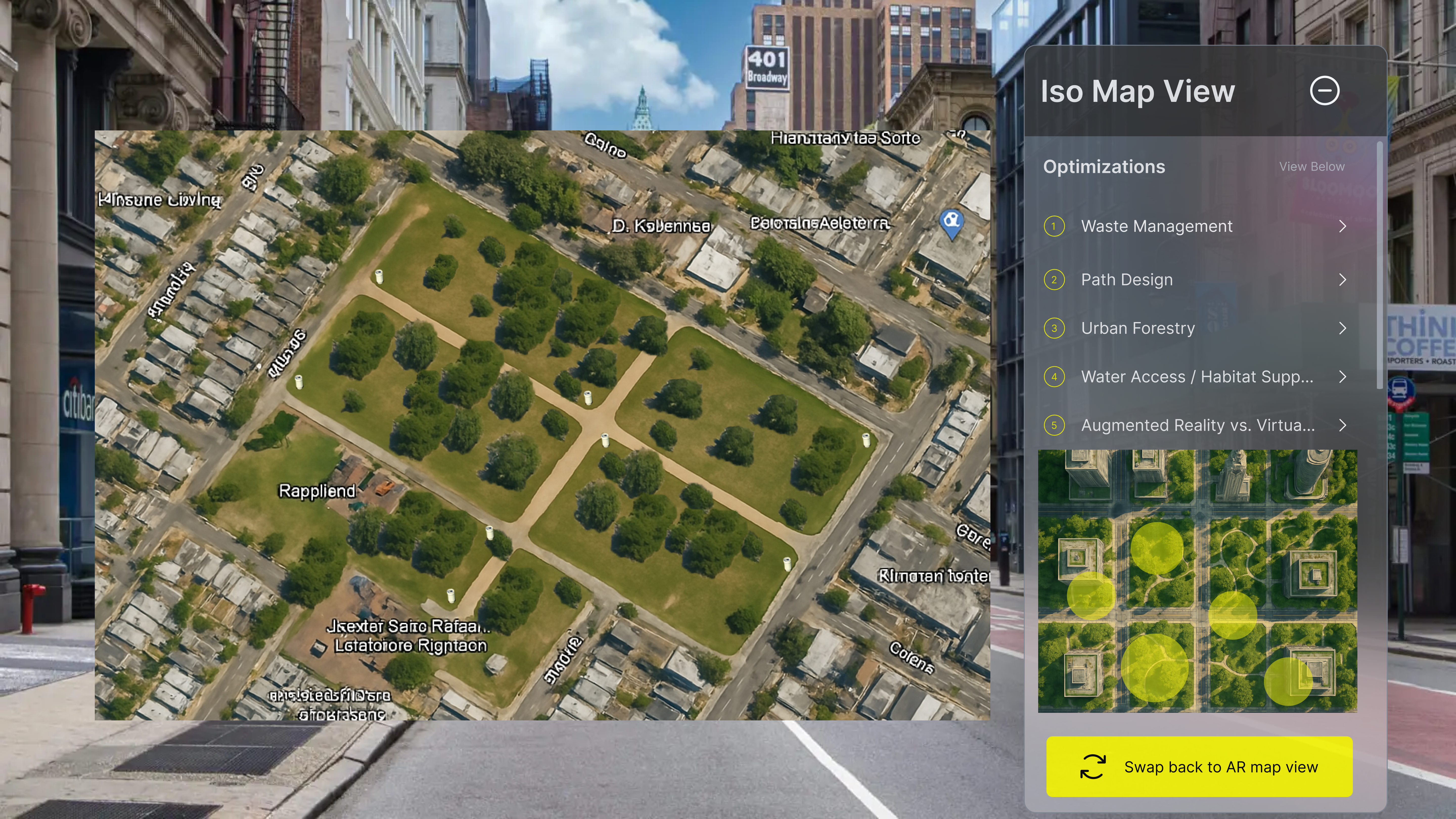
3. AR Map View
It offers a top-down augmented reality visualization of optimized city planning**, allowing users to see proposed improvements overlaid onto the real world. Following user testing and feedback, we decided to integrate this feature to enhance spatial understanding and engagement. With just "one click", users can seamlessly switch from the current map to the AR map view, gaining an immersive, bird’s-eye perspective of urban enhancements. This feature helps users better grasp the scale, layout, and impact of planning decisions, making city development more transparent and interactive.
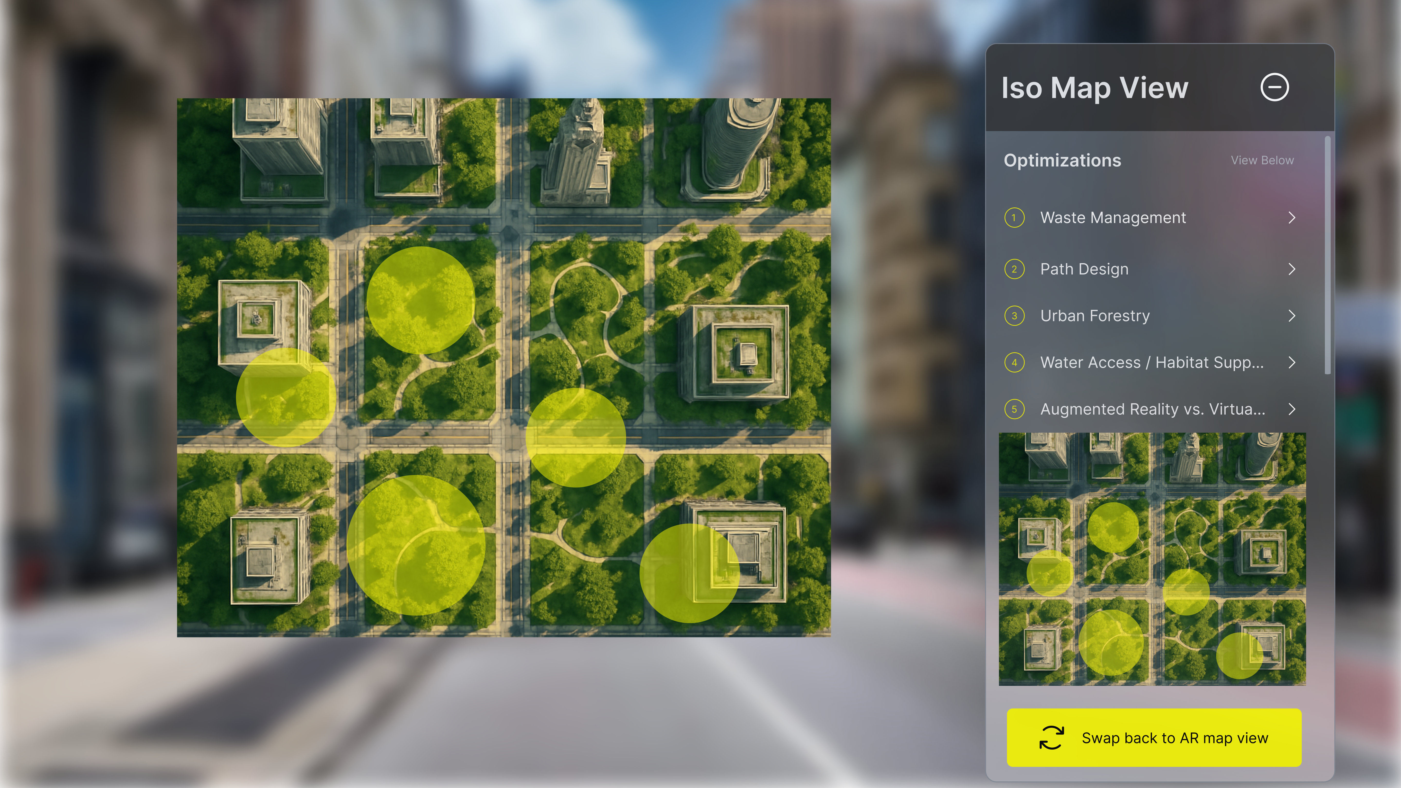
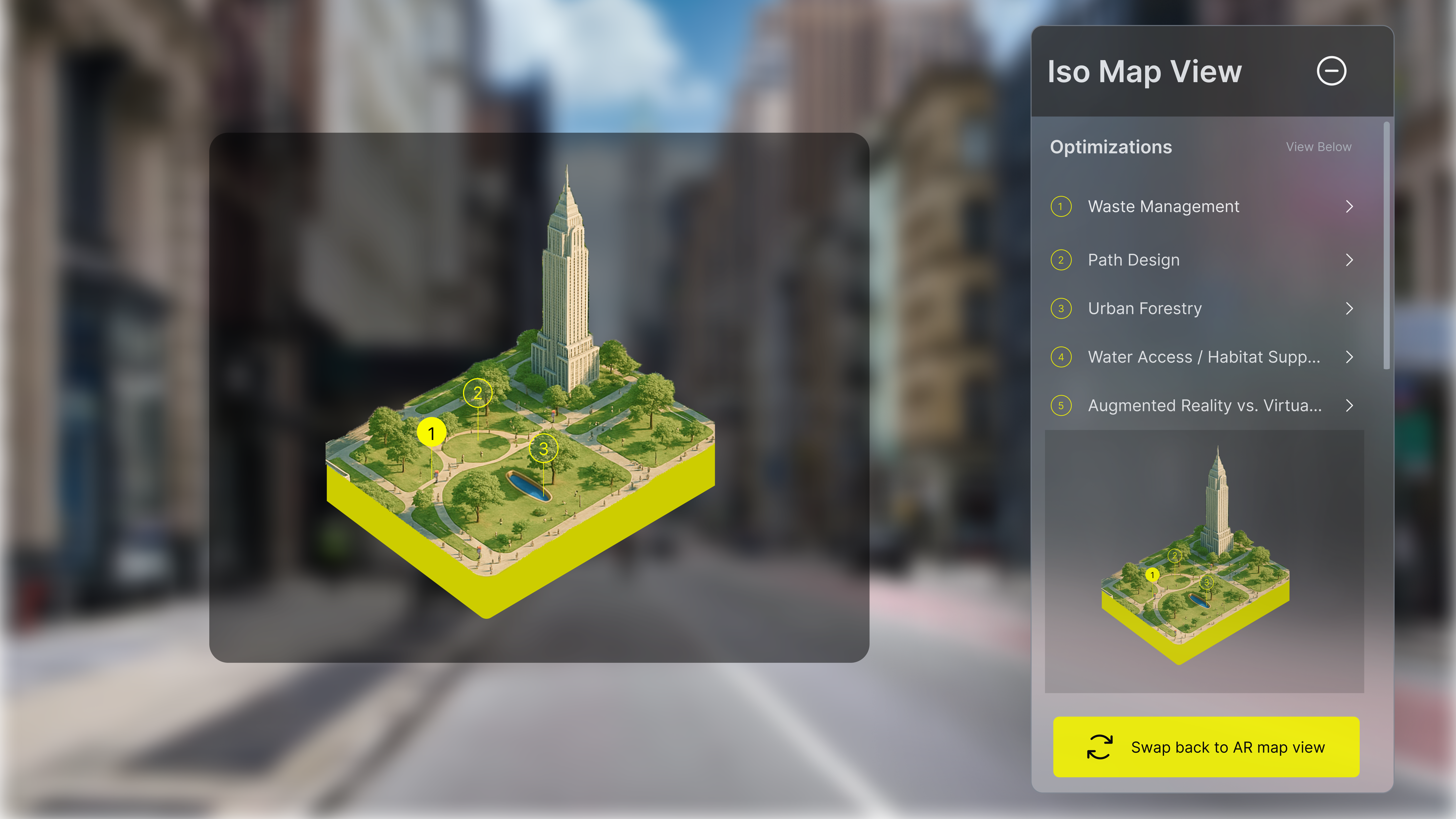
4. Isometric View
It provides a dynamic and engaging data visualization that renders the optimal use of space in a 3D environment. By integrating location-based services, this feature allows users to explore and interact with spatial data relevant to their surroundings. To enhance user engagement, gamification elements are incorporated, enabling intuitive navigation through the 3D space—turning urban exploration or planning insights into a more playful and immersive experience. This approach not only makes complex spatial information more accessible but also encourages deeper user interaction and understanding of optimized city layouts.
So How Does This Thing Actually Work
AI operates through a step-by-step process
to analyze and optimize spaces. It begins by taking a specific plot of land which could range in scale from a large public park to a small private backyard—and evaluates its current layout and potential. Using spatial data, environmental factors, and user-defined goals, the AI then generates tailored design solutions that enhance functionality, sustainability, and visual appeal. This adaptable approach makes it suitable for a variety of urban and personal planning scenarios, offering intelligent recommendations regardless of the space's size.
The AI redraws a more desirable walking path
The AI intelligently redraws walking paths to create more desirable, efficient, and user-friendly routes within a given space. By analyzing existing foot traffic patterns, terrain, accessibility, and surrounding features, the AI generates optimized pathways that enhance both functionality and aesthetic appeal. Whether in a park, plaza, or private garden, the redesigned paths aim to improve user experience, encourage natural movement, and support better spatial flow—making public and private spaces more enjoyable and accessible.
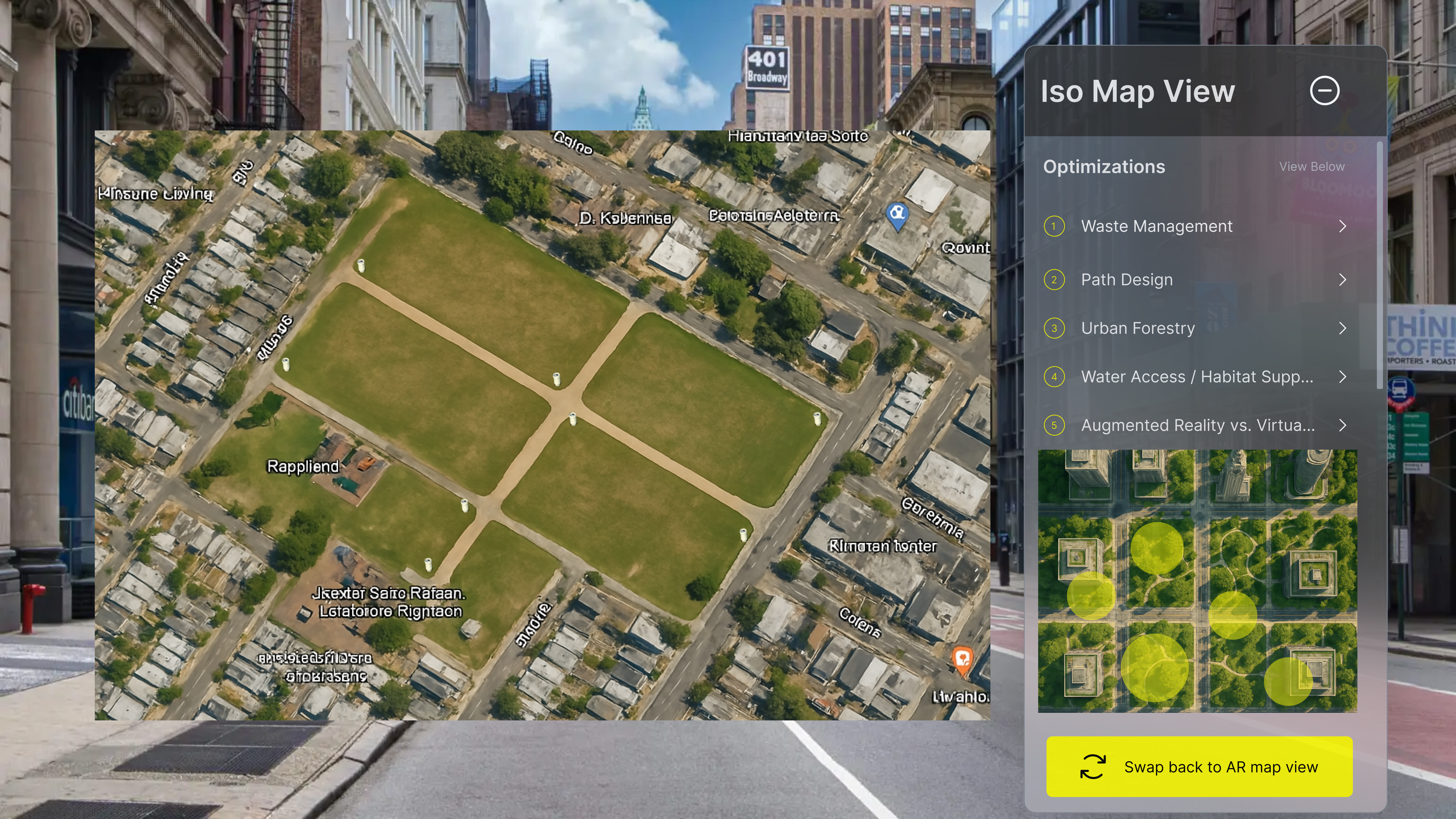
It then adds trash cans based off of human foot traffic
The AI then strategically places trash cans based on human foot traffic patterns, identifying areas where people are most likely to dispose of waste. By analyzing movement data and high-traffic zones—such as rest areas, path intersections, and entrances—the system ensures that trash bins are conveniently located where they are most needed. This thoughtful placement not only helps reduce littering but also encourages responsible waste disposal, contributing to a cleaner, more sustainable environment.
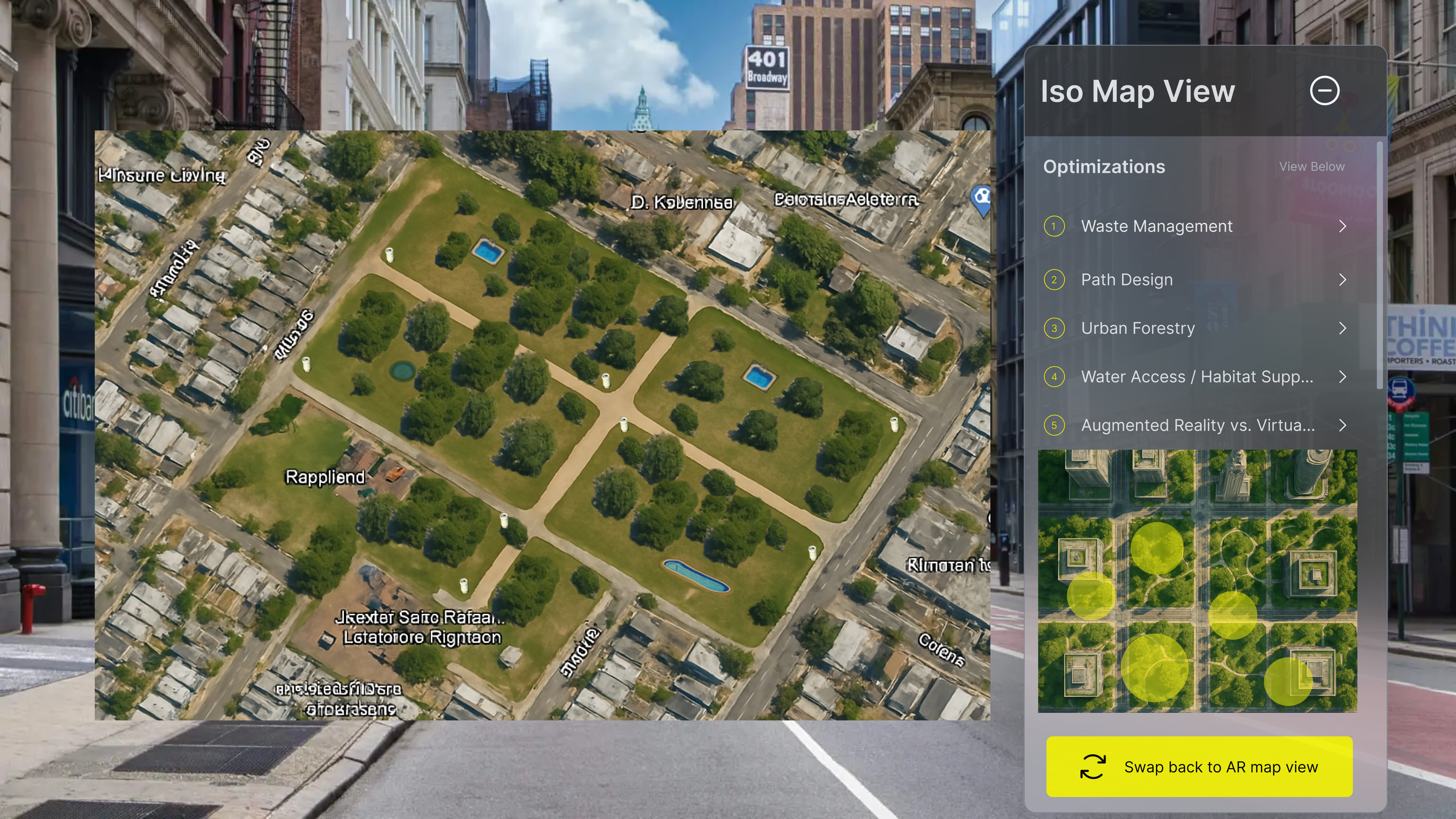
AI-Guided Tree Placement for Climate Comfort
The AI then predicts the optimal locations to plant trees based on temperature data, identifying areas that experience excessive heat or lack natural shade. By analyzing microclimates within the space, the system suggests tree placement that can cool down high-temperature zones, improve air quality, and enhance overall comfort. This data-driven approach helps create healthier, more livable outdoor environments, especially in urban areas affected by the heat island effect.
Interactive Visualization of Tree Placement in Real Time
As the AI completes its analysis, the selected tree locations are visually rendered on the screen using real-time simulation. These trees appear over the mapped environment in either 2D or 3D view, allowing users to immediately see how greenery will be distributed across the space. The visualization includes scale-accurate tree models, showing how they will provide shade, shape pedestrian flow, and enhance the overall aesthetic. Users can pan, zoom, or toggle between views to explore the impact of tree coverage from different perspectives—transforming abstract environmental data into a tangible and interactive visual experience. This not only aids decision-making but also encourages community engagement and collaborative planning.
Smart Pond Placement for Balanced Ecosystems
Lastly, the AI calibrates the optimal locations to place ponds by analyzing their distance from disposable bins and other environmental factors. By ensuring that ponds are situated away from areas with high waste accumulation, the system helps maintain cleaner water features and healthier ecosystems. This thoughtful placement supports biodiversity, prevents pollution, and enhances the overall aesthetic and ecological balance of the space—transforming it into a more inviting and sustainable environment.
Scalability
Future our users
Scope
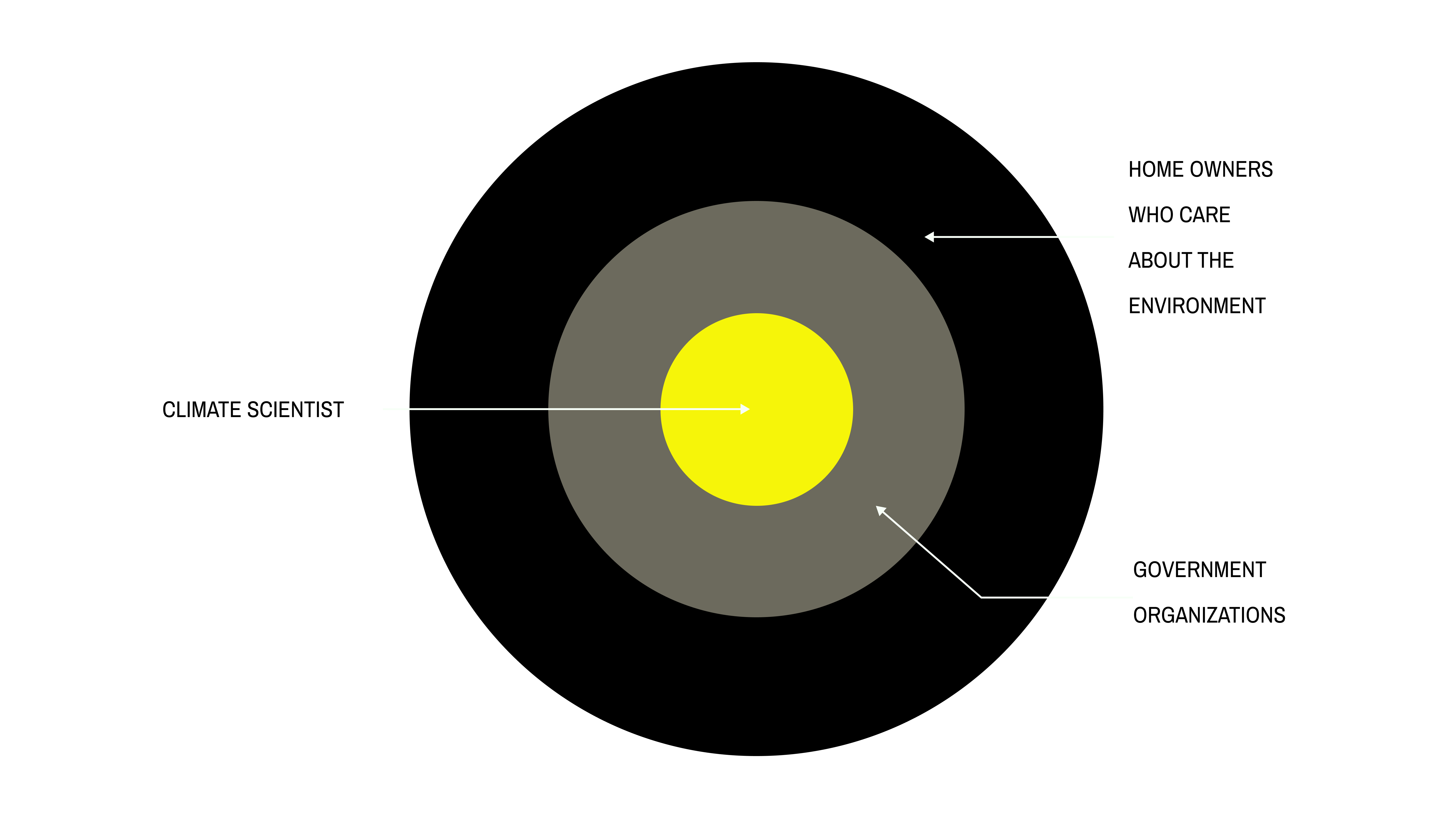
Our platform is designed to serve three distinct tiers of users. At its core, it caters to climate scientists, who rely on precise environmental data and advanced modeling to support research and decision-making. The second tier includes government organizations, such as city planners and environmental agencies, who use the platform to inform policy, infrastructure planning, and sustainable development initiatives. Looking ahead, we aim to expand access to a broader audience, empowering everyday citizens, educators, and community leaders with tools to better understand and engage with their local environments. By doing so, we hope to foster greater awareness, collaboration, and action toward a more sustainable future.
Positioning Statement
As designers, we believe that before you can change the world, you have to envision it.
We can help you see that world with EcoVision
Our Team